Why Maps Fail to Tell the Whole Story of Africa
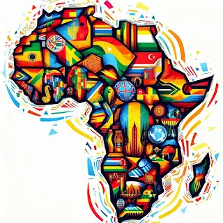
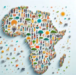
Africa's intricate nature cannot be captured on a single map.
Attempting to map Africa and its vast array of geographical, cultural, and historical intricacies on a single map is an exercise in oversimplification. For example, a map focusing on political boundaries may provide a clear view of the countries and capitals but neglects ethnic groups, languages, and traditions that crisscross African borders.
Likewise, while highlighting the continent's awe-inspiring natural features like Mount Kilimanjaro, the Nile River, and the Kalahari Desert, a physical map would not delve into the complex political and social dynamics that shape the lives of Africa's over 1.3 billion people.
Administrative maps might shed light on the internal divisions within individual countries. Still, they can't capture the broader regional interactions and historical legacies that have left an indelible mark on the continent's identity.
Maps do not accurately represent the true size of Africa due to a phenomenon known as map projection distortion. Africa's complexity defies simplification. To truly appreciate the richness of this continent, one must consult many maps, each designed to reveal a specific aspect of Africa's multifaceted character.
When studied together, these maps allow us to gain a more comprehensive understanding of Africa's geography, culture, history, and challenges, recognizing that one map alone can never encapsulate the entirety of this diverse and captivating landmass.
Africa's complexity defies simplification on one map.
To truly appreciate the richness of this continent, one must consult many maps, each designed to reveal a specific aspect of Africa's multifaceted character. When studied together, these maps allow us to gain a more comprehensive understanding of Africa's geography, culture, history, and challenges, recognizing that one map alone can never encapsulate the entirety of this diverse and captivating landmass.
Political maps help us understand the political landscape, physical maps show the natural beauty and challenges of the continent, and administrative maps help us understand the internal divisions and governance structures within countries.
The political map of Africa highlights the political boundaries and divisions within Africa. It shows countries, their capitals, and major cities. The purpose of a political map is to provide a clear understanding of the political structure of the continent, including borders and territories.
Physical map of Africa focuses on the natural features of Africa. It uses colors and shading to depict the landscape, including mountains, rivers, deserts, and other geographical features. This map is invaluable for understanding Africa's diverse terrain, climate, and natural resources.
An administrative map of Africa provides a detailed view of the administrative divisions within a country or region, including boundaries of states, provinces, regions, or districts within countries. This map is particularly useful for those studying African nations' administrative structure and organization.
Cultural maps depict the distribution of different ethnic groups, languages, religions, and cultural practices across Africa. They help in understanding the rich diversity of African cultures.
Historical maps show the evolution of African political boundaries over time, including colonization, decolonization, and border changes. They are crucial for historians and researchers studying Africa's past.
Topographic maps provide detailed information about the elevation and contours of the land. They are essential for various activities such as hiking, urban planning, and infrastructure development.
Climate maps illustrate the different climate zones in Africa, including arid deserts, tropical rainforests, savannas, and Mediterranean regions. They are vital for understanding weather patterns and agricultural planning.
Resource maps display the distribution of valuable resources such as minerals, oil, gas, and water sources. They are valuable for industries and governments engaged in resource exploration and management.
Transportation maps show the road networks, railways, ports, and airports across Africa. They are helpful for travelers, logistics companies, and urban planners.
Tourist maps focus on attractions, landmarks, and points of interest for travelers, including national parks, historical sites, and cultural destinations. They aid tourists in planning their journeys.
Population density maps of Africa illustrate the concentration of people in various regions of Africa. They are essential for demographic studies and urban planning.
Health maps display health-related data such as the prevalence of diseases, healthcare facilities, and vaccination coverage. They are valuable for healthcare professionals and policymakers.
Geological maps show the composition and structure of the Earth's crust in a given area. They are crucial for geologists and mining exploration.
Africa's true size is underestimated on maps
Maps do not accurately represent the true size of Africa due to a phenomenon known as map projection distortion. Map projection distortion is crucial in understanding why maps don't faithfully depict Africa's true size. When we try to transform the three-dimensional, spherical surface of the Earth onto a two-dimensional map, we encounter a problem: it's impossible to do so without some level of distortion.
The Earth is roughly spherical, meaning that when we try to flatten it onto a map, certain areas must be stretched or compressed. Map projections are methods used to accomplish this transformation, but they inevitably lead to inaccuracies in representing continents and regions' true sizes and shapes.
Being located near the equator, Africa is particularly susceptible to distortion on maps. Most world maps, such as the commonly used Mercator projection, exaggerate the sizes of landmasses as they move away from the equator towards the poles. This results in Africa appearing much smaller on these maps than it actually is.
In reality, Africa is the second-largest continent on Earth, covering a vast expanse of land. Its true size is underestimated on maps, leading to misconceptions about its scale compared to other continents. For instance, Africa is significantly larger than North America, Europe, and China, but it may not appear on many maps due to projection distortion.
To accurately represent Africa's size, cartographers and geographers often use specialized map projections like the Robinson projection or the Eckert IV projection, which aim to minimize distortion of size and shape across the continent. However, these projections are not as commonly used in everyday maps, leading to the persistence of the misconception that Africa is smaller than it actually is.
The distortion caused by map projections, especially on maps prioritizing navigational accuracy like the Mercator projection, can make Africa appear smaller than its true size. Understanding this distortion is essential for appreciating the vastness and importance of the African continent in its proper context.
Part of our African Geography Hub — discover how Africa’s land, people, and natural features shape its story.


