Posts

Showing posts from September, 2023


Chic African Culture Africa Factbook

Colonial Past of São Tomé and Príncipe
Image
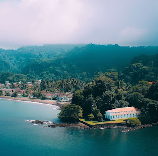
The colonial administration of São Tomé and Príncipe Islands and the history of Portuguese colonialism in Africa.  São Tomé and Príncipe, a pair of islands located in the Gulf of Guinea off the west coast of Central Africa, were among the early Portuguese colonial possessions in Africa.  Early Colonization of São Tomé and Príncipe São Tomé Island was discovered by Portuguese explorers in the late 15th century, around 1470. The island was initially uninhabited, and its fertile volcanic soil made it suitable for cultivating sugarcane, cocoa, and later coffee. The Portuguese established sugarcane plantations on the island, which relied on enslaved labor, primarily from the African mainland. The mainstay of São Tomé's colonial economy was agriculture, with sugarcane being the primary crop in the early years. The island's economy later shifted to cocoa and coffee production, which became major cash crops in the 19th and 20th centuries. Enslaved Africans and later indentured laborers

Sofala: A Key Stop on Covilhã's African Odyssey

Image
Sofala, historically known as a significant trading town, holds a special place in the history of Eastern Africa. Located on the eastern coast of Africa, in what is modern-day Mozambique, Sofala was a bustling and strategic port during the late medieval period and the Age of Exploration. Navigating the waters around Sofala was no small feat. The Indian Ocean currents and shifting sandbars made the approach to the Sofala coast treacherous. Pêro de Covilhã's successful navigation of these waters demonstrated his seafaring prowess and furthered Portugal's ambitions to dominate maritime trade routes. To Portuguese explorers, Sofala was not merely a geographical destination but a vibrant crossroads of cultures and trade during the late 15th century. The Age of Exploration in the late 15th century was a transformative era in African human history. It was a time when intrepid European explorers set out on perilous journeys to chart unknown territories, establish trade routes, and unco

The Salt Miner's Resilience

Image
The story of the Salt Miner's Resilience emphasizes that change, even when initially unwelcome, will bring unexpected blessings. Ahkeeni's discovery of the magnificent salt crystals symbolizes the idea that positive outcomes can emerge from adapting to change with a positive attitude. Ahkeeni The Salt Miner's Resilience African Folklore In the distant past, on top of Mount Elgon in Kenya, a humble salt miner named Ahkeeni lived. Ahkeeni was known throughout the land for his unwavering work ethic and indomitable spirit. He toiled daily in the salt mines, where the scorching sun baked the earth, and the salt lay deep below, waiting to be harvested. One sweltering morning, as Ahkeeni descended into the mines, he noticed something extraordinary. The entrance to the mine had changed. The path he had known for years was now blocked by a massive boulder, and a new, unfamiliar tunnel beckoned him to explore it.  Undeterred by the unexpected change, Ahkeeni ventured into the unknown

How Water Shapes Borders

Image
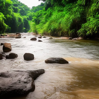
African rivers shape land, borders, create cultures, and history. Rivers are pathways; 30% of all borders in Africa are rivers. African rivers shaped countries, cultures, and civilizations with natural liquid borders. The continent of Africa is home to numerous rivers that have played significant roles in shaping its landscape and political boundaries. These water bodies have acted as natural barriers, demarcating borders between countries and sometimes influencing the development of cultures and civilizations. For instance, the Nile River, one of the world's longest rivers, flows through several African nations, including Egypt and Sudan. Its fertile banks have historically supported advanced civilizations and shaped the region's history. The Nile's course has also defined borders and influenced interactions between these countries. In West Africa, the Niger River has played a similar role. It traverses several countries, such as Nigeria, Mali, and Niger, serving as a cruc

Mshousa Price of Greed African Folktale

Image
Mshousa's Regret: An African Folktale Story of Appreciating Life's Simple Joys Mshousa Price of Greed African Folklore  On a moonlit night, when rest eluded every villager, Durmga, the revered great grandmother of the community, commenced weaving a mesmerizing tale of Mshousa. Mshousa had a modest home, a loving family, and enough to eat each day. Yet, he was plagued by a relentless desire for more. Mshousa believed that his life was ordinary and unremarkable, and he yearned for wealth and extravagance. One day, Mshousa's wish was granted in an unexpected way. A wealthy merchant passing through the village was so impressed by Mshousa's determination that he offered him a lucrative opportunity to work in the bustling city. Mshousa eagerly accepted, leaving behind his simple life and family. In the city, Mshousa was surrounded by opulence. He wore fine clothes, lived in a grand house, and dined on delicacies.  He reveled in his newfound wealth and soon forgot his humble o

Gold Fever in Zimbabwe: A History of Ophir's Wealth

Image
King Solomon's legendary gold mines in the Land of Ophir, located in Zimbabwe's Northern Regions The region where the Karanga tribes were centered, particularly in Zimbabwe's northern regions, is believed to be the biblical Land of Ophir, from which King Solomon obtained gold. This association highlights the region's historical significance due to its gold resources and wealth and prosperity.  The Land of Ophir is mentioned in the Bible, particularly in the Old Testament. It is associated with a place renowned for its wealth of gold, precious stones, and other riches. King Solomon was known for his wisdom and wealth and is said to have received the gold from the Land of Ophir to construct the First Temple in Jerusalem.  There are those who argue that Ophir is not a tangible location that can be discovered through conventional means. Instead, it is believed to be a mythical or legendary place that is associated with immense wealth and ri

Portuguese Penal Codes in Mozambique

Image
The Darkest Side of Portuguese Colonial Labor in Mozambique and the Native Labor Code of 1878. In the historical context of labor practices in Mozambique during the Portuguese colonial period, this southeastern African territory, twice the size of California, became significant to Portugal following the explorer Vasco da Gama's arrival in 1487.  Initially serving as a center for controlling sea trade routes to the East Indies, Mozambique later evolved into a full-fledged Portuguese colonial possession. In 1822, it was officially designated as an overseas province, a status it retained, except for a brief period from 1930 to 1951 when it was categorized as a colony. Ultimately, Portugal did not relinquish its hold on Mozambique until 1975. The labor landscape in Mozambique was significantly influenced by the Mozambique Company, which received a charter from the Portuguese government in 1891. This charter granted the company sovereign rights in present-day Manica and Sofala provinces

Sand Traveling from the Shores of Ghana to New England

Image
The journey of a grain of sand from the shores of Ghana to New England, USA, is an important reminder of the interconnectedness of all existence.  It serves as a reminder that even the smallest and seemingly insignificant elements of our world are subject to the grand tapestry of natural processes and the relentless passage of time.  It also invites us to reflect on the intricate web of relationships that underlie our existence and the profound implications of our actions on the global scale. The journey of a grain of sand from the shores of Ghana to New England, USA, shows how interconnected our world is despite vast distances. Sand grains on the shores of Ghana, like those on coastlines worldwide, are constantly subject to natural processes such as erosion. Waves, tides, and weathering gradually break down rocks and minerals, producing sand. The Atlantic Ocean separates Ghana from the eastern United States. Ocean currents, including the North Atlantic Drift and the Gulf Stream, are c

Scattering of Southern African of Nations

Image
Scattering of Southern African Nations during the Difaqane. Difaqane migration of the Nguni-speaking peoples of Southern Africa was characterized by conflicts, conquest, displacement, and the reshuffling of ethnic groups across Southern Africa. In the 19th century, Mozambique underwent significant changes due to the movements of many African groups who spoke Nguni languages in Southern Africa. The Nguni-speaking peoples of Southern Africa include the Zulu, Xhosa, Nhlangwini, Mpondo, Ndebele, and Swazi. They are primarily found in the southeastern regions of Africa, including parts of South Africa, Swaziland, Zimbabwe, and Mozambique.  These migrations, which happened between the 1820s and 1850s, greatly impacted Mozambique and Africa as a whole, as they were disruptive and often violent events unfolding during this period. These migrations of people were known as the Difaqane migrations. Difaqane is derived from the Sotho language and translated as the scattering or forced migration.

Architectural Glory: The Nouakchott Mosque of Mauritania

Image
Exploring the Nouakchott Mosque's Design   At first glance, the Nouakchott Mosque's most prominent feature is its soaring minaret, one of Africa's tallest. This towering structure serves as a call to prayer and a beacon that guides the faithful toward their place of worship. The minaret's height allows the call to prayer, or Adhan, to resonate far and wide, calling the community to come together for their daily prayers and congregational gatherings. It's common for mosques to be named based on their location, as in the Nouakchott Mosque in Nouakchott, Mauritania. The mosque's design pays homage to the classic elements of Islamic architecture. Like in many Islamic architectural designs, the dominant colors at the Nouakchott Mosque tend to be earthy and neutral tones, with white being a particularly prevalent color. These color choices have cultural and practical significance in Islamic architecture. Its grand entrance is adorned with intricate geometric patterns

Food, Drink Offerings at Rock-Cut Tombs

Image
Loaves of bread, cakes, wine, water beer,  oils, and perfumes were offerings Ancient Egyptians offered to the deceased at Beni Hasan Rock-Cut Tombs. A rock-cut tomb is a type of burial structure that is created by carving or excavating directly into natural rock formations. Rock-cut tombs are literally carved or excavated out of solid rock. This means that the tomb chambers, corridors, and other features are created by removing the rock material from the surrounding natural formation. Many of these rock-cut tombs feature decorative elements, such as wall paintings, inscriptions, and carvings.  In the Beni Hasan Rock-Cut Tombs, the ancient Egyptians paid homage to their departed by presenting a variety of offerings. These included loaves of bread, cakes, wine, water, beer, oils, and perfumes. These offerings were a heartfelt gesture to honor and ensure the well-being of the deceased in the afterlife, reflecting the profound significance of their beliefs and funerary customs in ancient E

Sudanese Kingdom of Ghana

Image
The Sudanese Kingdom of Ghana was the ancient Ghana Empire, a prominent West African kingdom known for its role in the trans-Saharan trade. The Kingdom of Ghana, not to be confused with the modern country of Ghana, was one of the earliest known Sudanese kingdoms. Its capital was Kumbi Saleh. It was a center of trade and had a complex political and economic structure. Historical significance of the Kingdom of Ghana, one of the earliest known Sudanese kingdoms. The Kingdom of Ghana, a historical entity that should not be confused with the modern Republic of Ghana, occupies a significant place in the annals of African history as one of the earliest and most influential Sudanese kingdoms. This medieval West African kingdom thrived between the 8th and 13th centuries and holds a special distinction for several reasons. Ghana's emergence as a powerful state in the region marked the beginnings of a series of advanced Sudanese kingdoms. Its historical significance stems from its role as a p

White Moors and Black Moors of Mauritania

Image
Defining Moorish Bidan or White Moors and Haratin or Black Moors Identity and Diversity. The term Moor originated from the Greek word Mauros or Maouris, which referred to dark-skinned people or inhabitants of North Africa. Over centuries, it became a broad and somewhat imprecise label for the various peoples living in North Africa, including Berbers and Arabs. In the Republic of Mauritania, most people are called Moors. They come from a mix of Arab and Berber backgrounds. But something important to know is that they, like most of the world, make distinctions based on the color of their skin while looking at things like family and where they come from to categorize themselves. Because of this, two main groups have formed over time: the Bidan, who are sometimes called the White Moors, and the Haratin, who are known as the Black Moors. These groups have different histories and cultures, as well as the color of their skin. Social descent and skin color have historically shaped the Moorish

Ancient Energy Source of Sarkin Ruwa

Image
The Ancient Energy of Sarkin Ruwa, the King of the Water Sarkin Ruwa is the West African Hausa culture revered spiritual energy, the guardian of all things water, making sure it flows and nourishes the Earth in the most extraordinary ways. In the grand tapestry of the natural world, few forces possess the mystique, the sheer might, and the profound influence that water holds. An embodiment of life and power, water transcends mere chemical composition, captivating our senses and imagination.  At the heart of this aquatic dominion stands a figure deserving of the loftiest accolades: Sarkin Ruwa, the King of the Water. To those who understand the true potential of this elemental ruler, it becomes evident that water's sovereignty reigns supreme. Imagine a realm that can both nurture and destroy, bestow life and take it away—a realm that can carve canyons out of rock and cradle civilizations with gentle tides. This is the kingdom of Sarkin Ruwa, where the ebb and flow of its currents po

Ghana-Togo Border Closing in 1986

Image
Closing the 680-mile-long Ghana-Togo border in September 1986 was initiated by the government of Togo triggered by Ghanaian Armed protesters. In September 1986, a significant and historically notable incident unfolded along the Ghana-Togo border in Lome. Armed protesters crossed this international border to overthrow President Gnassingbé Eyadéma. This incident led to the closure of the border. President Gnassingbé Eyadéma's lengthy tenure in power, which spanned from 1967 until his death in 2005, was marked by many challenges and complexities. One of the primary challenges Eyadéma encountered was the presence of a persistent and often vocal political opposition.  Eyadéma's rule was criticized for alleged human rights abuses, including political repression, censorship of the media, and restrictions on freedom of speech and assembly. Eyadéma survived multiple coup attempts during his time in office.  The Ghana-Togo border is approximately 1,094 kilometers or about 680 miles long.

Mesurado Bay Birth of a Liberian Colony

Image
Liberia was designated as a settlement for freed African slaves by the American Colonization Society, primarily due to the strategic importance of Mesurado Bay.  Liberia's history as a settlement for freed African slaves is intricately tied to the American Colonization Society's objectives and the strategic significance of Mesurado Bay. In the early 19th century, the American Colonization Society (ACS) emerged to address the complex issue of slavery in the United States.  The society sought to establish a colony in Africa where freed African Americans could be resettled and provided with opportunities for a better life. Liberia was chosen as the destination for this resettlement effort. One primary reason for selecting Liberia was its strategic location, notably Mesurado Bay. Situated on the West African coast, Mesurado Bay offered several advantages. It provided a suitable harbor for ships, which was vital for trade and transportation. Additionally, the bay's proximity to

Ethiopian Castles and Emperors

Image
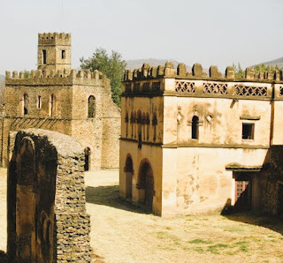
In the annals of history, King Fasil, or Fasiledes as he is known, decreed Gondar as the enduring capital of Ethiopia in the year 1636. Under the successive reigns of noble monarchs, a remarkable transformation unfolded. What was once a humble encampment evolved into a walled-in fortified compound of great import, christened Fasil Ghebbi. This compound encompassed six grand edifice complexes, nearly twenty regal palaces and esteemed structures, and an impressive tally of some thirty venerable churches. Francesco Bandarin Photo of Castles of Gondor The castles of Gondar, also known as the Gondar Castle Complex or the Royal Enclosure, are a  collection of historical buildings located in Gondar, a city in northern Ethiopia.  The Gondar Castle Complex was the Ethiopian Empire's royal residence and administrative center during the 17th and 18th centuries. The complex consists of several castles, palaces, churches, and other structures, each reflecting different architectural styles. Not

Wise African Proverb

Wise African Proverb

More Articles to Read from Chic African Culture

Show more