


Four Dimensions of Climate Change in Africa
Four Dimensions of Climate Change in Africa’s Three Most Populated Countries: Nigeria, Ethiopia, and Egypt
Climate change affects Nigeria, Ethiopia, and Egypt—Africa’s three most populated countries—in all four dimensions of food security: availability, accessibility, utilization, and system stability. These shifts have far-reaching effects on livelihoods, health, and economic resilience.
Explore and understand Africa through her food systems, climate resilience, and cultural knowledge.
Climate Change in Nigeria, Ethiopia, and Egypt
According to the Food and Agriculture Organization (FAO), climate change threatens food security by disrupting production, market flows, and nutrition. Rising temperatures and unpredictable rainfall bring droughts, floods, and desertification that destabilize local economies and make food more expensive and less nutritious.
Short-term impacts come from frequent extreme weather events. Long-term effects stem from shifting rainfall patterns, rising temperatures, and water scarcity, which challenge farmers and threaten stable harvests.
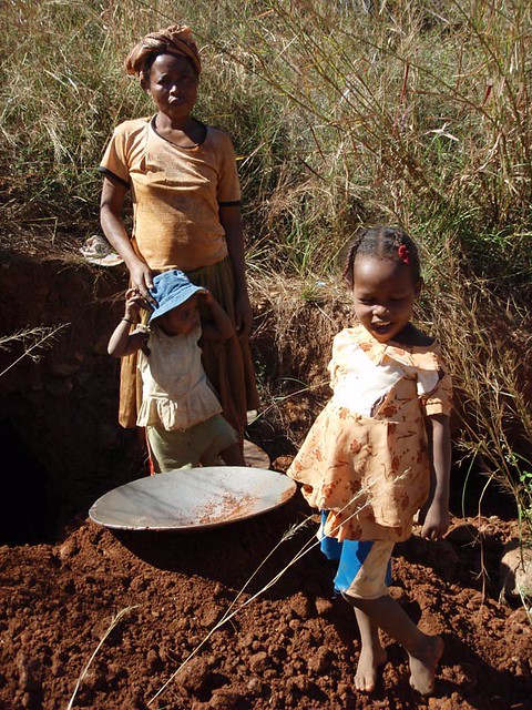
Nigeria: Agriculture and Desertification

Nigeria is the continent’s largest cassava producer and a major rice consumer and importer. Water-intensive crops like rice and wheat face higher stress as droughts intensify. Windier, hotter conditions force crops to use more water, while unpredictable rainfall shortens growing cycles.
Desertification threatens fertile land, especially in the north—states like Kano, Katsina, Sokoto, Jigawa, Yobe, and Zamfara are known as “desertification frontline” regions. Expanding sand dunes bury roads and villages, while rivers and lakes dry up after rains.
Ethiopia: Drought and Rainfall Instability

Four out of five Ethiopians rely on agriculture for their livelihood. El Niño–induced droughts in 2015–2016 caused devastating crop failures, with up to 90% of production lost in some areas. Southern and southeastern Ethiopia, where communities depend heavily on livestock, suffered extreme pasture and water shortages.
The regions most affected include:
- Oromia: Borena, Guji, Bale lowlands
- SNNP: South Omo, Segen, Gamogofa lowlands
- Somali Region: Fafan, Dollo, Jarar, Korahe, Nogob, Shebelle
Below-normal rainfall since 2015 has made recovery slow, leaving millions food insecure and dependent on aid.
Egypt: Water Scarcity and Nile River Politics

Egypt’s agriculture depends almost entirely on the Nile River. With more than 90% of the country desert, the Nile provides over 85% of its freshwater. Population growth, irrigation demands, and upstream projects like Ethiopia’s Grand Renaissance Dam have sparked water tensions.
Historic treaties such as the 1929 Anglo-Egyptian Treaty and 1959 Nile Waters Agreement gave Egypt control over the Nile’s flow. But climate change, rising temperatures (projected +1.5°C to +4°C by 2050), and changing rainfall patterns threaten this fragile balance.
In 2015, Egypt, Sudan, and Ethiopia signed the Khartoum Declaration to negotiate water-sharing. Yet, Ethiopia’s dam construction continues to reshape the politics of the Nile, raising concerns over Egypt’s water security.
Population impact (2015 estimates):
- Nigeria: 181.5 million
- Ethiopia: 99.3 million
- Egypt: 89.1 million


