Since 2007
What Is the Wettest Country in Africa
Sierra Leone, Liberia, and Equatorial Guinea are the three wettest countries in Africa with the highest annual rainfall.
Sierra Leone, Liberia, and Equatorial Guinea are the wettest countries in Africa according to The World Bank weather, water, and climate statistics. Africa has the world’s least developed weather, water, and climate observation network, with half of its surface weather stations not reporting accurate data.
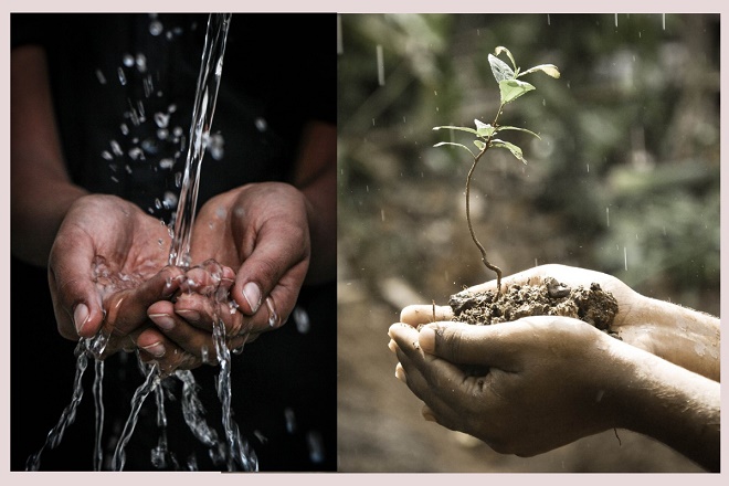
All crops need water to grow and produce yields. The most important source of water for crop growth in Africa is rainfall. Too much water means a waste of water which is so precious in dry countries. It can also lead to a rise of the groundwater table and an undesirable saturation of the root zone. Too little water during the growing season causes the plants to wilt. Long periods during which the water supply is insufficient, resulting in loss of yield or even crop failure.The climate determines the amount, intensity and distribution of rainfall which have a direct influence on the effective rainfall. When rainwater falls on the soil surface, some of it infiltrates into the soil, some stagnate on the surface, while some flows over the surface as runoff.
When the rainfall stops, some of the water stagnating on the surface evaporates to the atmosphere, while the rest slowly infiltrates into the soil. From all the water that infiltrates into the soil and, some percolates below the root zone, while the rest remains stored in the root zone.
Sierra Leone Rainfall and Farming
Sierra Leone receives 2,526mm of precipitation per year. The climate is tropical hot, humid; summer rainy season May to December and winter dry season December to April. Rainfall along the coast can reach 495 cm or 195 inches a year, making it one of the wettest places along coastal, western Africa.
Population clusters are found in the lower elevations of the south and west; the northern third of the country is less populated. The fear of disease infection, natural and climate change-related disasters and man-made disasters are looming in the country given recent experiences of the Ebola crisis and the floods in different parts of the country.
In the aftermath of the country’s 11-year civil war along with the recurrence of disasters undermine Sierra Leone’s efforts to eradicate hunger and malnutrition and to achieve sustainable development. Apart from destroying lives and properties, they threaten livelihoods, diminish people’s potential to empower themselves and engage in long term investments that will lift them out of poverty.
In Sierra Leone, the livelihoods of many people depend on having secure and equitable access to and control over natural resources. However, increased pressure on land, forestry, and fisheries compounded by weak tenure governance has led to ownership disputes.
Women represent 70 percent of the agricultural labor force of Sierra Leone, holding an important role in natural resource management and food production. Despite their contribution, however, women are often discriminated against and denied ownership, access to or control of the land. In addition, discriminatory, customary and statutory laws that favor men hinder the economic impact of women’s agricultural activities.
Liberia Rainfall and Water Systems
Liberia receives 2,391mm of precipitation per year. Although this is much higher than the quantity of water required for crop growth, an acute water deficit is experienced anyway during a 3 to 5 month period, particularly in the uplands.
The climate is tropical hot, humid; dry winters with hot days and cool to cold nights; wet, cloudy summers with frequent heavy showers. Facing the Atlantic Ocean, the coastline is characterized by lagoons, mangrove swamps, and river-deposited sandbars; the inland grassy plateau supports limited agriculture.
More than half of the population lives in urban areas, with approximately one-third living within 50 miles, 80 km radius of the capital, Monrovia. Approximately 64 percent of Liberians live below the absolute poverty line.
This means that the food security situation for refugees remaining in the country is already precarious. Access to education is limited. An estimated 80 percent of schools, health service structures, water wells, and sanitation facilities have been either destroyed or abandoned since 1998.
Before the outbreak of civil war, agriculture accounted for about 40 percent of GDP and Liberia had been a producer and exporter of basic products - primarily raw timber and rubber. In 2000, agriculture and forestry contributed over 90 percent of export earnings, mainly from rubber, timber, cocoa and coffee.
Liberia can be divided into two kinds of river systems, the major basins, which drain 97 percent of the territory in a general northeast-southwest direction. Of these, the six major rivers, originating in Sierra Leone, Guinea or in Côte d’Ivoire, are the Mano, Lofa, Saint Paul, Saint John, Cestos and Cavalla, and together drain 65.5 percent of the country.
The short coastal watercourses, which drain about 3 percent of the country. Internal renewable surface water resources are estimated to be 200 km3 per year and internal groundwater is estimated to be 60 km3 per year; all of the latter is believed to be drained by watercourses.
Thus, the total internally produced renewable water resources become 200 km3 per year, while an additional 32 km3 per year comes from Guinea and Côte d’Ivoire, bringing the total renewable water resources to 232 km3 per year. Liberia is one of the African countries with the highest amount of renewable water resources per inhabitant: more than 71 000 m3 per year.
Equatorial Guinea Rainfall
Equatorial Guinea receives 2,156 mm of precipitation per year and has violent windstorms and flash floods. No part of the Equator passes through Equatorial Guinea; the mainland part of the country is located just north of the Equator.
Despite Equatorial Guinea being the third wettest country in Africa and one of the richest African oil countries, the tap water is non-potable water that is water that is not of drinking quality. Continental Equatorial Guinea is bounded by Cameroon to the north and Gabon to the east and south.
Near the coast are the small islands of Corisco and Great and Little Elobey. Bioko, by far the largest of the islands, lies off the coast of Cameroon in the Bight of Biafra. Annobón, a volcanic island, lies south of the Equator and almost 400 miles or 640 km to the southwest of Bioko.
All islands are inhabited. Fishing is both industrial and artisanal, with canoes, using hand lines and small fishing nets. Seafood catches include tilapia, tuna, and shrimp along with other freshwater fishes. Bioko Island is the largest island in the Gulf of Guinea and its capital location is 779 sq miles or 2,017 square kilometers.
It is shaped like a boot, with two large volcanic formations separated by a valley that bisects the island at its narrowest point. The 121 mile or 95 kilometer coastline is steep and rugged in the south but lower and more accessible in the north, with excellent harbors at Malabo and Luba, and several scenic beaches between those towns.

|
| One who journeys during the time of rains does not look to the skies. |
Don't throw away the old bucket until you know whether the new one holds water.
Together we build awareness that boost harmony, education, and success, below are more links to articles you will find thought provoking.
- Where is Shashamane Ethiopia the African Rastafarian Promised Land
- Cooking with shea butter oil
- Worst serial killers recorded in history are women
- Indigenous healers and plants used
- Night running illness or magic
- What is back to Africa